Saturday, September 15, 2012

Historic Waynesville NC and Senior Moments

Saturday September 15, 2012

Today we decided to see downtown Waynesville, North Carolina.  So, we jumped in the car and headed south on 276, then west on 19, then south on 276 again, then made a right turn to somewhere.  Wherever we were, it wasn't downtown Waynesville.  So, when all else fails, get out the GPS.  Even the GPS had trouble finding it, but after making a couple of circles, we finally made it to downtown.

The sign said "Historic Waynesville" but darned if we could find any history there except for several old buildings.  Actually, the downtown area is nice and is filled with all types of little shops and several interesting restaurants.  We walk up one side on main street and down the other side and even hit a few side streets stopping in several interesting stores.  But, the only thing we purchased was some dog treats for Kallie.  They are made to help keep her teeth clean and freshen her breath.  After all that walking, that was our only purchase.  Kitty says, "shopping with her husband is like hunting with the game warden!"  Hey, if she asks me if I like something, I just say no and she moves on.  I only had to say no about 14,000 time in two blocks!  Ha!

 
Here's a couple of shots of downtown Waynesville, NC.


These sculptures were made from industrial scrap material and is there to commemorate the musical history of Waynesville.  Maybe that's the history part of "Historic Waynesville"?


After all that heavy shopping, we had really worked up an appetite.  So, we had a very nice lunch at a restaurant called "The Sweet Onion".
 
 
Ok, now for a rare senior moments.  Since this campground is full of seniors, we all get a chuckle of sharing our senior moments with each others.  So, we thought we'd share this one with you.  Here goes.  The other night Kitty was trying to put some eye drops in her eyes, but kept missing her eyes.  So, she asked me to help.  I tipped her head back and opened her eye lid just like I'd seen the eye doctor do, and sure enough, I missed her eye too.  The stuff squired out at an angle instead of straight out.  So, I tried to wipe off the tip of the eye drop container figuring something was blocking the hole.  We tried it again with the same results, missing her eye even more than before.  Then it dawned on us what was wrong... the cap was still on the bottle.  We just stood there and laughed for several minutes.  Please don't tell our children, they already think we are crazy!


Blue Ridge Parkway

September 13, 2012

We left Creekwood Farm RV Park and headed south on highway 276, the west on highway 19 to get on the Blue Ridge Parkway.  The Blue Ridge Parkway starts at mile marker #1 in Virginia's Rockfish Gap at the southern terminus of Shenandoah National Park's skyline Drive.  It ends at mile marker #469.1 Oconaluftee in Great Smokey Mountains National Park.  Construction started on the parkway in 1935, and is a two lane winding road through the mountains, often in elevation over 5-6000 feet.  There are 26 tunnels, all but one in North Carolina.  Some of the tunnels have low clearance issues and tall RVs like ours would have to drive through the center of the tunnel and hope no one is coming the opposite direction.  So, we left the RV at the campground and made our drive in our car.

We entered the Parkway near mile marker 451 and were heading towards Virginia.  We stop at this overlook and took this picture.

I wanted to get that sign in the picture to help us remember the name of this overlook.  But, I didn't realize I was standing in front of the sign and now we can't remember the name of this overlook.  A senior moment I guess!
 
Here's some shots of the road from another overlook.


We drove a little farther and decided to stop and have lunch.  We stopped at The Orchards Overlook at 3810 feet elevation.  I know that because I included the sign and nobody standing in front of the sign this time!
 
Here's some more shots from this overlook.


There is no advertising signs on the Parkway, which makes the trip even more beautiful.  But, you need to have a booklet that tells what's at each exit so you know where to stop for shopping, food, or gas.  The Parkway is always going up or down hill and some of the grades are steep with sharp curves.  The max speed is 45 MPH. 
 
While we were driving, Kitty kept saying "what if our breaks fail", or :what if we slide off the road.  They would never find us!"  The farther we drove the whiter her knuckles got.  So after only going about ten miles, we took an exit and headed back to the campground and some reasonably flat roads.  She is never going to be a mountain girl.  But, after seeing some of these mountain girls, maybe that's a good thing.  Ha!

Tuesday, September 11, 2012

Great Smokey Mountains NP

Tuesday, September 11, 2012

We left Somerst, Kentucky about 11:00 am eastern time and headed east to I75 south bound.  Just before reaching Knoxville, we stopped at a rest area and had a lunch Kitty had packed.  We can't stop at most restaurants due to my special diet requirements and we don't want to even think about trying to maneuver a 38 foot 5th wheel in some tight quarters.  So, we always pack a lunch and stop in a rest area.  We drove about 235 miles and reached Waynesville, North Carolina around 4 PM.  Creekwood Farm RV Park, in Waynesville, is one mile south of I40 and about 80 miles southeast of Knoxville, Tn. and 20 west of Ashville, NC.

It's a nice well kept campground with a small creek running behind our site and a larger creek along the eastern side of the campground.  They offer free WI-FI, cable TV, a dog run area, breakfast on Saturday mornings and live entertainment on Saturday nights.  They also have an RV wash station and the restrooms and laundry areas are spotless.

 
Here we are on site #38.
Kallie just finished her chores!
 
 Wednesday, we headed to the Great Smokey Mountains National Park.  We took US highway 276 south to highway 19 west, then US 441 north through the Cherokee Indian Reservation and entered the Great Smokey Mountain National Park via the southern entrance at Oconaluftee visitors center (say that three times real fast!).  Most people probably enter from the north going through Gatlinburg, Tn. and we wanted to avoid the touristy areas.
 
We are now headed for the highest peak in the Smokey's called Clingmans Dome.  It is 6643 feet above sea level.  We were lucky today, it didn't rain on us while we were up that high.  Clingmans Dome gets 8 feet of rain per year, and is often covered in clouds.  We took our rain coats just in case, but were glad we didn't need them, and there wasn't enough clouds to prevent photos. 

We are following the road to Clingmans Dome and the Oconaluftee river runs along side the southern portion of the road.
 
Here's Oconaluftee River
 
 
Here we are in the parking lot near the top.  We still have to hike a half mile trail to get to the observation deck.
 
It was 80 degrees when we started up this mountain.  Its now 57 degrees in the parking lot! 
These next several shots were taken as we walked up the half mile path climbing another 330 feet higher in the thin air.


At about 6500 feet high, the Appalachian Trail crossed our path.
Notice the dead trees in this photo below, and several other photos to come.  I will tell you later what's killing them later in this blog.
 
The thin air, steep climb, and my reduced lung capacity made us think about turning around a few times.  But, I needed to prove to myself that I could do this, so we rested a few times and continued our upward climb.
 
 Here's a shot of the observation deck that stands 6643 feet above sea level.
 
We stopped at the base of the observation deck to catch our breath.  Then, I started up the winding walk way to the top.  Kitty had enough exercise for the next few months, so she stayed at the base. 
 
Here I am, out of breath, but I made it to the top.  I did it!
I've been accused of having my head in the clouds, and here's proof of that!
 I don't know what the air temperature is up here, but I am guessing it is 50 degrees or less.
 
Here's Kitty at the base of the observation deck.  (No, she is not flipping me the bird!)
I had to zoom in on that photo so you could see who it is.  I am really higher than it appears.
 
These are photos from the top of the observation deck.
 
 
These photos were taken while heading down the trail back to the parking lot.


We made it back down to the parking lot.  It is much easier walking down hill than up hill.  Next, we are headed for Newfound Gap.  It's only 5046 feet high!
 
Here's some photos from Newfound Gap.


I am sure you noticed all the dead trees in these photos.  It's a little bug called balsam wooly adelgid.  It has killed over 95% of the Frasier Firs over the past decade.  The only way to stop it is to spray each tree individually, and that takes a lot of time and manpower.  We saw a lot of dead trees in South Dakota and Wyoming.  It is really alarming to see all of the devastation caused by bugs and fires.
 
There's lots more to see here, but it will be getting dark soon and we didn't want to be driving these mountain roads at night.  So, we headed back.
 
Tomorrow, we will take a ride on the Blue Ridge Parkway!  Stay tuned. 


Sunday, September 9, 2012

Civil War and Marinas

Sunday, September 9, 2012

Fishing Creek, Somerset, Ky.  The weather man delivered a perfect day, so we headed out to see some local history.  The Battle of Mill Springs was small compared to the larger more popular civil war battles, but none the less important.  The Union defeated the Confederates here and this was a much needed Union victory because it kept Kentucky from falling into Confederate hands, it allowed the Union to control the river,  and it ended a long string of Confederate victories.

When we arrived at the museum, we were the only visitors and had the place to ourselves.  We started out with a 20 minutes video which explained how the battle started and ended.  While we were waiting for the video to start another couple came into the small theater.  We started talking to them and found out that she was the Great, Great Great Granddaughter of Brigadier General Felix K. Zollicoffer.  They came from Nashville to find our more about their long lost relative who was killed in the Battle of Mill Springs.

But, the manner in which General Zollicoffer  was killed was so bazaar, you won't believe it.  But, believe it, it's true.  So, let me set the stage.

It's 6:30 AM on January 19, 1862.  The Confederates had marched six hours through a cold rain that turned the road into mud.  The Confederates had not yet issued uniforms, so General Zollicoffer was wearing his blue Union uniform for an earlier war several years ago. The Confederates encountered the Union and the battle began.  Now it's getting foggy and the smoke from the battle combined with the fog made visibility only a few yards.  General Zollicoffer was unaware that the Union reinforcements just arrived and Zollicoffer thought his men were firing on their own troops.  So he rode over to investigate and encountered Colonel Fry (Union), who had ridden down the road to get a better look at the Confederate position.  In the smoke and confusion neither man recognized the other.  Zollicoffer (wearing his blue uniform) looked like a Union officer, and Zollicoffer ordered Colonel Fry to cease fire, telling Fry he was firing on friendly troops.  Thinking Zollicoffer was a superior Federal Officer, Fry began to ride back to his regiment and give the order, but at that moment, a Confederate staff officer rode up and yelled to Zollicoffer "General, it's the enemy!" and began firing his pistol at Fry.  He missed Fry, and Fry drew his gun along with several other Union solders began firing at Zollicoffer and his staff officer, killing them both.

Shortly, the Confederates gathered up Zollicoffer's body and leaned him up against a tree.  That tree became know as the Zollicoffer Tree.  The tree stood until the spring of 1995 when it was struck by lightning.  The battle caused 246 Union casualties, of which 55 died.  The Confederates had 533 casualties, of which 150 died.


Here's what the Confederate hospital looked like with over 500 casualties in a small house converted to a hospital.  Bodies everywhere!
 
 
Here's what's left of the hospital today.


This is in front of the museum.  You can see the head stones in the National Cemetery to the right side of the picture.
 
 
Our next stop was at a local orchard where we picked up some fresh peaches.  Across the street was a barn with a quilt painted the front.


Then we stopped at Lee's Ford Marina and took this shot.
 
 
Then we headed south to Burnside, Ky.  We stopped at Burnside Island State Park and checked out the campground.  It was pretty and had only a few level spots.  Everything is either going up hill or down hill.  I guess that's what happens in hill country.  Ha.
 
 
Here's a shot of Burnside Marina.


And that was the end of a very nice day.  Monday is cleaning day; clean the car, clean Kallie, clean our clothes, and clean anything that doesn't move!  Not very exciting, but stuff that has to be done.
 
Tuesday morning, we head to North Carolina and the Smokey Mountains and the Blue Ridge Parkway!


Friday, September 7, 2012

Lake Cumberland, KY

Friday, September 7, 2012

Today is moving day.  We are leaving Dawson Springs, Kentucky and heading about 200 miles east to Somerset, Kentucky and a COE campground called Fishing Creek.  We packed up and left Dawson Springs about 10:00 am and arrived at Fishing Creek Campground around 2:30 pm Central time.  However, since we crossed into the Eastern time zone, our arrival time was 3:30 pm local time.  We made one stop for fuel and had our usual travel lunch that Kitty had packed.

We got a list of open sites at the campground office, and took our car through the campground checking out all the open sites.  Most of these sites were too small, but we decided we could fit into site #6.  We knew this would be a tight squeeze, but it was a nice level site with a view of the Lake.  As we started to back into this site, a neighbor, who camps here all the time, came out and suggested we try site #5.  It is across the street, but had an uphill climb.  The neighbor said we could probably fit on our original site, but wouldn't have as much room as site #5, and his friend has a unit about our size and really likes site 5.  When we originally looked at site 5 and knew it was larger, but were concerned with the up hill approach and knew we would have to jack the front end pretty high to get level. After considering all the pros and cons, we decided to take the neighbor's advice and switch to site 5.

We did have to raise the front up pretty high, but not as high as our original site in Dawson Springs.  That was at nose bleed heights, this one was almost to nose bleed heights.  This site is encased with a stone wall going around all three sides and has plenty of room for a picnic table and fire ring.  It also has a view of the lake and we are glad we changed.

Speaking of the Lake, our neighbor informed us the water level is down about 50 feet due to  construction on the dam that will take another year to complete.  This makes the lake much smaller and it's interesting to see what the bottom of the lake looks like when the water level is so low.  But, all things considered, we'd rather have the higher water level.

Here's some shots of our site. 


Here's the site across the road from our site.


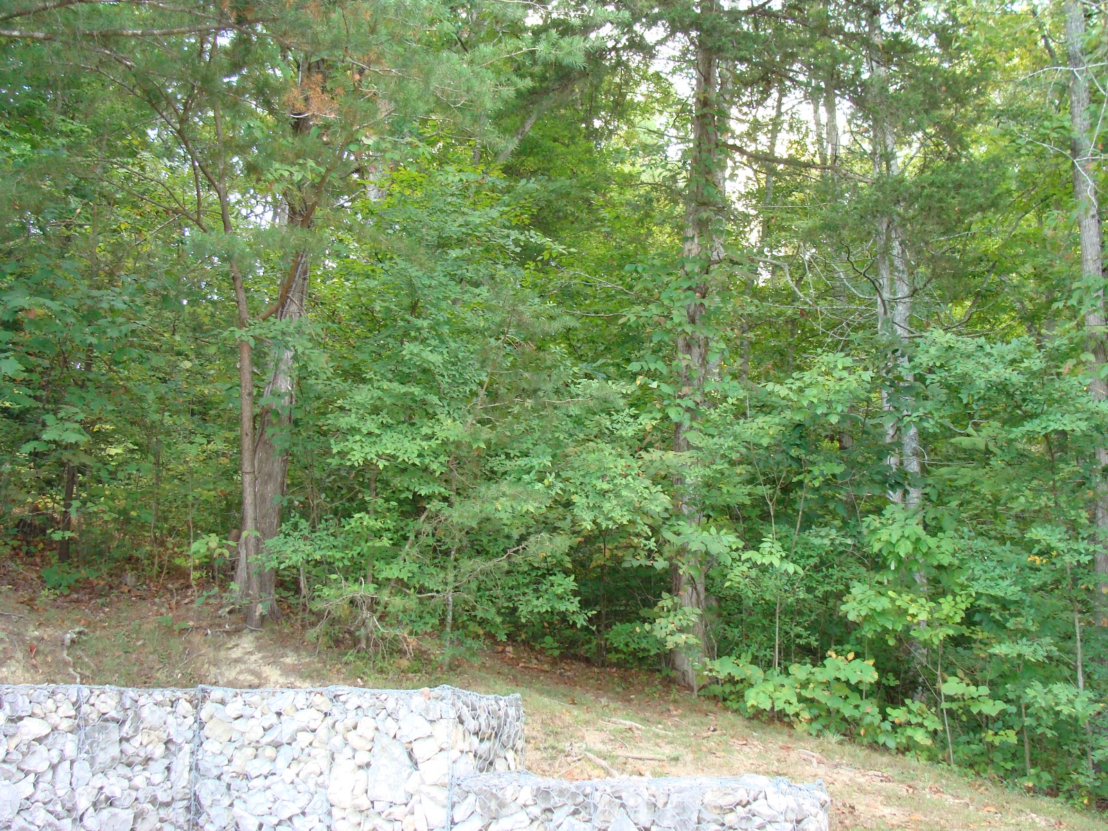
Here's a shot of the trees and stone wall at our site.


It rained most of the day Saturday.  This put a damper on our plans to see the nearby civil war battlefield and museum.  There was suppose to be the annual Poker Run at Lee's Ford Marina, with the big cigarette boat races and lots of other activities including a wet t-shirt contest.  For some reason, Kitty didn't want to go - she kept muttering something about being bad for my heart -??!!  Guess she didn't want to get her t-shirt wet!  Ha!   Anyway, it was all cancelled due to the weather.
 
So we headed out looking for the tourist information center to see if there is anything else in this area that we might want to see while it was raining.  We went in the direction we though was correct, then changed our minds and turned around and went the opposite direction.  To make a long story short, our original direction proved to be correct.  We finally got to the tourist information center and found it was closed on weekends after Labor Day.  So, we did some shopping for groceries and scouted the area for future stops.  Looks like Kitty found a Cracker Barrel so guess I know what one of those stops will be.

Tomorrow, the weather promises to be better.  So, we'll stop at the civil war museum and battle field, then visit a couple of marinas.  Stay tuned!

Thursday, September 6, 2012

Alex Football

Thursday, September 6, 2012

Our last night in Dawson Springs we traveled to South Hopkins Middle School for an 8th grade football game.  Our grandson, Alex, played defensive end and kick off team.  Here's some shots of Alex in action.  Alex is number 22.

 Alex #22 blocking from defensive position
 
Alex closing in on the ball carrier.
 
Alex #22 on kick off team.
 
 
Alex's team made a thrilling come from behind victory in the closing seconds of the game.  After the game there was a special program to recognize the eight graders on the team.
 
 
Here are our grandsons, Brandon & Alex, and daughter, Karri, as they announce Alex's name and position.
 
 
It was a fun night and Alex and his team played well.  After the game we hurried back home and just beat a storm that was fast approaching during the last part of the game.  We made it back as the wind really began blowing.  It was like a giant leaf blower blowing leaves everywhere.  Then the rain and lightning came and we were glad we made it safe and sound.  It was a great way to end a nice visit with the family.


Sunday, September 2, 2012

Dawson Springs Part 4

Saturday September 1, 2012

We drove to Karri's house to meet her after she got off of work.  Then she drove us to Madisonville and treated us to a enjoyable meal at Cracker Barrel.  After we finished eating, we went to my favorite place, Wal-Mart (Ha!) to do some shopping for the family get together Sunday at Kay and Donnie's.  All in all it was a nice evening despite the Wal-Mart stop.

Sunday, September 2, 2012

We picked Karri up around 2:30 pm and drove to Madisonville.  Before going to Kay's for the family get together, we stopped at the cemetery to see Pap's grave (Kitty's dad).  When we got to Kay's, everyone started preparing the food they brought and Kay was getting ready to take the pork loins out of the oven.  We really had a feast.  In addition to the meat, we had fresh green beans, corn, cooked apples, Jello salad, biscuits, toss salad, and German chocolate cake for dessert.  I haven't see that much food since Thanksgiving! 

Here's a shot of the group.

Seated on the floor is Kami.  On the couch L to R is Donnie, Kay, Hunter, J.B., Jack.
Back Row: Kitty, Brandon, Alex, Kristian, Karri, and Craig
 
This next shot is Karri and her boys.
 
L to R: Brandon, Alex, Karri, and Kristian
 
Monday, September 3, 2012 Labor Day
 
Kobie had spent the night with us and Karri came by to visit around mid day.  Hurricane Isaac was responsible for a very soggy Labor Day.  It rained on and off all day and some of the rain was pretty heavy.  The campground was less than half full to begin with, and emptied out by mid afternoon.  There was only one other camper, across from us,  in the campground.  It's like we have our own private campground.  Later we threw some chicken on the grill and were able to get it cooked between the rain showers.  Then Karri left to prepare for the daily grind tomorrow.
 
One of the nice things about being retired, is we don't have to prepare for the daily grind anymore, and we're loving it!