Thursday, October 11, 2012

Island Hopping

Thursday, October 11, 2012


Today the weatherman delivered a delightful day and we intended to take full advantage by heading to Tybee Island, seeing a lighthouse and a fort.  Kitty packed our lunch and we jumped in the car and headed a few miles North of Skidaway Island, then east on Highway 80 crossing the Intercoastal Waterway and followed the signs to Fort Pulaski.

Fort Pulaski is named after Count Casimir Pulaski, the polish hero of the American Revolution war who lost his life in the siege of Savannah in 1779.  You know this guy, the kids get a day off from school each year in his honor.  Anyway, construction on the fort began in 1829 at a cost of $1 million.  They used 25 million bricks building the fort and it took 18 years to finish it.  Much of the labor was supplied by the slaves.  It's walls are 7 1/2 feet thick and the fort was considered unbreachable.

On November 10, 1861, the Confederated abandoned their positions outside of the fort on Tybee Island and the Union quickly set up 11 artillery batteries and 36 guns on Tybee Island.  These were aimed at Fort Pulaski nearly a mile away.  The Confederates felt their position was safe at the fort because this fort was  believed to be unbreachable.  But, they had no idea the Union had experimental rifle cannons that could bore through the fortified walls of the fort.  After 30 hours of shelling the fort, the Confederates surrendered the heavily damaged fort, and 384 Confederate officers and soldiers were taken prisoners.  From this point on, the military would no longer make forts out of brick and mortar.

Here's the entrance to the fort.
 
 
There is a draw bridge entrance.
 
 
These are shots of the moat that surrounds the fort.  It is 7 feet deep and 32 to 48 feet wide.  Water is supplied to the moat from a canal that was dug from the Savannah River.
 
 
The next three shots were taken inside the fort from the upper level.


More of the outside of the fort. I enlarged the first picture so you can see some of the damage to the fort from the Union shells.  In fact, much of this wall had to be rebuilt when the fort was restored due to a gaping hole in the wall from the shells fired a mile away.


From the fort, we took a walking path to see the light house on Cockspur Island.  The path is 1.7 miles through cabbage palms, red cedar, spiders, snakes, and a hungry alligator.  Lucky for them, we didn't see any of the last three varmints mentioned! 
 
The Cockspur Island light house was built in 1856 and marked the entrance of the south channel of the Savannah River.  It was a silent witness of the shelling of Fort Pulaski in 1861.
 
We've seen dozens of lighthouses and this has to be the smallest.


Now it's time to hit the beach at Tybee Island.  It was very windy when we were there, but this is a very nice beach.  Check it out.


We ate our lunch on the beach and then took our beach chairs to the edge of the waves and enjoyed the surf pounding in and the birds pooping on our heads! Ha!  As I have said many times, you can not starve on the beach because of all of the sand-which is there.  I heard that groan!
 
This was a great way to end our day.  We went back home and fixed supper and went to bed with smiles on our faces.


Wednesday, October 10, 2012

Skidaway Island, Georgia

Wednesday, October 10, 2012


The weatherman lied today.  It was suppose to be in the high 70's or low 80's.  It barely got to 70 degrees by 2 pm.  But who's complaining?  I'll take the sunshine upper 60's most any time except when we had planned to be at the beach today.  It was a little chilly and we were a little slow getting started today.  We move like molasses when it's cool.  Besides, Kitty did a load of laundry and we had a nice conversation with a couple of fellow campers here at Skidaway Island State Park near Savannah.

Instead of going to the beach, we changed gears and explored Skidaway Island.  Outside of the state park, most of the Island is full of gated communities and a golf course.  As we mentioned yesterday, the stores are all designed to not look like stores.  We were looking for a gas station and drove right by it not knowing it was a gas station.  After filling the tank, we drove a few miles to the end of the island where land meets the Intercoastal Waterway.  Here's some pictures of what we saw.


Then we decided to go back to the park and finish the trail we started walking yesterday.  We ran out of daylight and only walked 1 mile of the 3 mile trail.  We were going to finish the 2 mile section today while we still had plenty of daylight.  This section of The Big Ferry Trail includes a stop by an old liquor still from back in the 30's and some earthworks built during the civil war.  The Big Ferry Trail got its name because it is the trail the island folks would take to get to the ferry, which is no longer in operation.  Despite the dangers to our well being from vicious Bobcats, attacking alligators, slithering snakes, and chewing chiggers with big teeth, we forged ahead full of faith that our hiking skills would get us through this handicapped accessible trail!
 
 
This is the earthworks made by slaves during the civil war.  This was part of the Confederate defense position in this area.  Due to the difficulty of defending this position and getting supplies to it, it was abandoned before Sherman arrived to take control of Savannah for the Union.  Pardon my finger in the upper left
 
If Kitty stands there any longer, she will be covered in moss like these trees.
 
The next two pictures are what is left of an old liquor still from the 1930's.  Folks would cross the Intercoastal and sneak on to the island and fire up their stills - away from the "revenuers".


This trail is full of tree roots.  I managed to trip over everyone of them!
 
 
After the hike, we went back to camp and relaxed before fixing supper.  Another enjoyable day in the full timers life!  This is a beautiful campground!


Tuesday, October 9, 2012

Some Sights of Savannah

Tuesday, October 9, 2012

The weather is a little better today, it's still cool, but at least the sun is shinning.  We headed out of Skidaway Island State Park with two stops in mind.  One at the island post office to mail some birthday cards and check on getting general delivery mail there, and the other stop is the tourist information center.  We decided to take Kallie along for the ride.

We mailed our cards and found out the island post office can not accept general delivery mail.  Then we headed to the tourist information center.  Now, this is not your normal tourist information center!  It is downtown Savannah in an old train depot that has been restored and converted into a museum, tourist center and restaurant where you can eat in a rail car.  It is also the starting place for the trolley tours of downtown.  The trolley tours are about 90 minutes long and make 16 stops throughout the city where you can get off and walk around and pick up another trolley and go to the next stop.  They are also pet friendly and Kallie got to take her very first trolley ride.  She was a very good girl and took in all of the sights and sounds of Savannah.  I think she enjoyed the trip, but she was trying to run at full speed when is was time to get off!

After the trolley ride, we walked a couple of blocks and took some pictures.

 
This is the deport/museum/visitor's center. When it was a depot, the trains would pull into this long building to load and unload passengers.

 
This is the restaurant with the dinning car on the left.

Here's some of the downtown area.

 
Many of the squares had fountains like this one.


Here's an old house downtown with some youngsters in front!


We are standing in front of James Edward Oglethorpe 1696-1785.  He lived to be 89 years old which back in that time was the exception.  But, he was a busy man in those 89 years.  He founded the colony of Georgia in 1732 and the city of Savannah.  He was also a soldier and philanthropist.
 

By now it is mid afternoon and we hadn't eaten lunch so we headed back home to fix a bite to eat.  Then we walked part of the Big Ferry Trail at our campground.  Since we started on this trail later in the afternoon, we only walked two miles of the 3 mile trail.  Here's what we saw.


We headed up the observation deck to take some pictures.


This is the Intercoastal Waterway.
 
You can see the marsh land between us and the Intercoastal.
 
We walked another mile through the forest.  I had one eye on the ground looking for alligators and snakes, the other eye looking in the trees for any overhead snakes.  It's hard to walk down a path when you can't watch where you're walking.  With Kallie in the lead, I had nothing to worry about.  No... I am not afraid of snakes!  What made you think that?  Ha!  More fun tomorrow!


Sunday, October 7, 2012

Skidaway Island State Park near Savannah, Ga.

Sunday, October 7, 2012

We packed up Sunday morning and left Camp Pedro in Dillon, SC heading south on I95 to Savannah, Georgia.  This is one of our longer runs.  It was about 230 miles, and we made only one stop for our usual picnic lunch Kitty had packed earlier.  We arrived at Skidaway Island State Park near Savannah, Georgia around 2:30pm.  As the name indicates, the park is on an island separated from the main land by the Atlantic Intercoastal Waterway, and there is only one road to and from the island.  There's not a lot of stores on the island, but the few that are here all have the look of a southern plantation.  It reminded us of Hilton Head which is just about 20 miles north of here.

The campground has 87 sites all with water, electric, and cable (all of the necessities!), but the sites do not have sewer hook ups.  So, everyone stops at the dump station prior to leaving the campground.  The rest rooms and laundry area are very nice and very clean.  That's important since we will be here for 10 days, and will be showering at the bath house and doing laundry.  We really like this campground, but maneuvering a 38 foot fifth wheel around these trees was a little tricky.

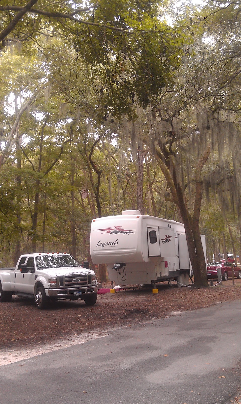
Here's a couple of shots of our campsite and the moss on the trees.
 
 
Here's a good view of the Spanish Moss.
 
 
I don't know why it's called Spanish Moss.  It's not from Spain and it's not really moss.  It's an air borne plant.  Over the years, many people have tried to find a use for this stuff.  They put it in pillows and mattresses.  But, Spanish Moss has little chiggers that live on this plant.  So, that's were the saying "sleep tight and don't let the bed bugs bite" comes from! Ha  You heard it here first folks!
 
 
Monday, October 8, 2012
 
When we arrived at Skidway Island State Park yesterday, it was sunny and 89 degrees.  Today, it's very cool and raining.  It's a good day to run some errands and make a few quick shopping stops while getting the lay of the land here.  We drove to the Island post office but it was closed because it's Columbus Day.  Then we headed into Savannah and stopped at Wal-Mart (of course), Camping World, and Home Depot.  The stores are all "hidden" behind island themed looking arcitecture with no obvious signs visible from the streets.  That makes looking for a particular store - even if you are sure you are on the correct street - very difficult at times.  It also makes the areas very attractive and less commercial looking. 
 
The weatherman promises a better day for Tuesday and we are hoping that he is correct with this particular forecast.
 

Friday, October 5, 2012

Friday October 5, 2012

We packed up, hooked up, and made our slow journey from Surf City (Laniers Campground) to  Holly Ridge, NC.  We made the 6 mile trip staying at 35 mph and driving with our fingers and toes crossed (not easy to do!) hoping that none of our tires would blow out before we reached the tire store.  Of the four RV tires, three had knots or bubbles on the inside side wall of the tire.  Since these bubbles were on the inside side wall, we didn't know they were there until Kitty mentioned seeing something on the inside of the RV tires as she followed the 5th wheel to Surf city.  So, we checked the tries carefully and found knots the size of a quarter on three tires.  The tire store does not have a remote unit to change tires at our site, so we had to make the stress filled trip knowing the tires could blow any second.

But, we made it, the tires were ordered earlier in the week and were waiting to be installed.  It took just over an hour to change and balance the tires and we were on our way.  Since we planned for the tire change out to take a few hours, we figured to be getting a late start on a Friday afternoon and planned to drive only 135 miles to Dillon, SC.  We headed south going around Wilmington, NC then west and north west to I95, then south barely crossing into South Carolina.  We were only on I95 about two miles before getting to our exit for Camp Pedro in a place call South of the Border,  and has a Mexican theme to the hotels, campground, amusement park, and restaurants.  The campground is very nice and very well kept. 
 
Here's our site #103


This is a shot was taken early down the main drag of the campground. Later in the day, the campground would be nearly full.


We are staying here only two days, leaving Sunday to make a run to Savannah Georgia about 4 hours away.

Tuesday, October 2, 2012

Wilmington NC Sights

Tuesday, October 2, 2012

It's another rainy day in Surf City, NC.  We decided to drive about 25 miles to Wilmington, NC to do some sight seeing.  Our first stop was a Petco to get some dog food for Kallie.  There just happened to be a Cracker Barrel near by and it just happened to be lunch time.  That's either great planning or shear luck. Ha!

After lunch, we made our way down to the Wilmington Port area to see the USS North Carolina Battleship from WWII.  We were here many years ago and the weather was spitting rain on and off, so we didn't take a tour, we just took pictures instead.


This shot shows some of the harbor area in the background.
 
You can tell we are getting farther south by the moss on the trees.
 
We drove another 20 miles south to the end of the Island and stopped at Carolina Beach.  Even though it was a gloomy day, the beach was very inviting.
 
 
Near by is Fort Fisher Historic Site.  Fort Fisher was built during the civil war to protect Wilmington Harbor and the entrance to Cape Fear River.  In 1862, the Confederates started to add more fire power to this critical location.  Many critical supplies for General Lee's army came through Fort Fisher and were shipped by rail to Virginia.  The Confederates knew all too well the importance of protecting this port.  On December 24, 1864 the Union army attacked the fort.  After two days of fighting, the Union had made little head way and decided to withdraw.  They returned for a second time on January 12, 1865 with over 50 war ships and 3300 Union infantry.  The war ships pounded the fort with over 10,000 rounds while the Confederates fired just over 600 rounds from their fort.  In a few hours the fight was over and the Union took control of the fort, thus, cutting off the main supply line to General Lee.  Now it was just a matter of a few months and America's deadliest war would be over.


There is not much left of the fort now.  These mounds were built by soldiers and slaves as bunkers to protect the canons and ammunition from being destroyed by canon fire from Union ships.


We had a few more things on our list of things to see, but, it's getting late so we headed back to Surf city.  Maybe we will make a trip back here before we depart on Friday.  Friday will be a little tricky getting 6 miles down the road with four bad tires on the fifth wheel.  We just hope none of the bubbles on the tires blows while we make the short trip to the tire store.
 
 
Ok, are you ready for another mystery picture?  What the heck is this thing?  Let us know what you think it is by sending us an email.