June 30, 2012
We departed the KOA in Newton, Iowa, after surviving the storm the previous night. The drive on this part of I80 east was a good road, but not exciting, and that's the way we like it. Although, it makes for a boring blog.
We arrived at Pine Country RV Park in Belvidere, Illinois around 3 pm. This was the end of our 3 week 3317 mile jaunt to/ Wisconsin, Minnesota, South Dakota, Wyoming, Montana, and Iowa. Whew! We don't plan to travel that many miles in the next several months.
We had reserved site number 8 because the site we had when we were here three weeks ago (#26) is a little small for our rig and not very level. But, when we checked in, we found that once again Pine Country has bumped us off of the site we reserved and had paid in advance. The same thing happened with our reservations back in May. But, we had already scouted out other campgrounds before we left and don't intend to return to Pine Country. However, our reservation has us staying in the dust bowl at Pine Country until July 16th.
This campground has gravel roads and is very dusty due to the drought that has spread over 26 states. Somehow that dust works its way into everything in the RV and our vehicles. There is no need to wash the RV or the vehicles, they'll be dusty again before the sun goes down. We decided to wait and do our cleaning after we depart this campground. You know... any excuse not to clean, right?)
We saw these same dry conditions throughout our entire trip. Certainly, this means the farmers are really suffering and we can expect higher food prices. Not good!
Before departing on our trip 3 weeks ago, we had taken our car to our friends house to store while we were gone. So, after we were set up and had delicious pit BBQ from a place Belvidere, we headed over to Glen and Laura's house to pick up our car. Since Sean has a drivers permit, so we let him drive the truck over to their house and then drive the car back to the campground. It's about a 40 minute trip each way. It was the end of a very long, tiring day but great to end it with by visiting good friends! This was a very enjoyable, informative trip for us. Kallie did great and was the perfect "RV Mutt".
July 1, 2012
It's very hot again and we don't have much on the agenda today. Tomorrow we take Sean back to central Illinois, so, he was busy gathering his things together, Kitty did some Laundry, while I washed the travel dirt off the 5th wheel. Later, we decided to eat supper out and celebrate a great trip. Besides, it is too hot to cook. (any excuse to not cook, right?)
Saturday, June 30, 2012
Friday, June 29, 2012
Iowa Storms
June 29, 2012
We are leaving Chief White Crane State Park in Yankton, SD. Instead of continuing east on I90, we decided to take the southern route back to Illinois. So, we swung east and picked up I29 heading south, then got on I80 heading east. This route is 481 miles back to Belvidere, Illinois and is about 50 miles shorter than staying on I90 back to Belvidere and it gives us the opportunity to see some different country side. Although, the drive across Iowa is much the same as Illinois with all of the farm land. If you've seen one corn field, you've seen them all; but, the Iowa interstates are extremely rough in this part of Western Iowa.
Since its 481 miles back to our reservations at Pine Country in Belvidere, Illinois, we decided to divide the drive into two days instead of one long day. So, we found a KOA in Newton, Iowa. I am not a fan of KOAs and this campground did nothing to change my opinion. We had a pull through site because we were just going to stay long enough to eat and sleep and be on our way in the morning. We didn't even unhitch from the truck.
This was one on the most uneven pull through sites we've seen, and there's dark clouds moving in fast and thunder not far off. So, after several attempts at jockeying the 5th wheel to find the least uneven spot, we used some leveling boards and were almost in panic mode as we hooked up the utilities.
This is where Sean's help really paid off, and we were set up in record time. With not a second to spare it started raining, the wind was howling and the rain was getting heavier by the second. Lighting was flashing everywhere, thunder was booming in our ears. Kitty and Kallie were both shaking in their boots (well, actually, Kallie doesn't have any boots). Suddenly our power went out, then a large branch from a tree across the street blew over nearly hitting our truck. Branches were flying everywhere, hail was slamming our roof, and the deafening sound of thunder made us feel like we were in the middle of Custer's last stand.
After the storm passed, everyone was outside checking for damage, including the campground manager. We were really lucky not to have any damage and the rain washed some of the bugs off the front of the 5th wheel! Soon, the power was back on and we had supper and a quiet evening until bedtime. The tv has not been on but twice during the entire three week trip and this was before we left Belvidere and the local stations had a pretty strong signal. Sean was a trooper about tolerating the lack of media entertainment and the company of the "old timers" (that's Kitty).
Sunday, June 24, 2012
It's a long way to Illinois
June 24, 2012
Now it's time to start the long trek back to Illinois from Hardin, Montana. We are now heading east on I90 and plan to stop in Wall, and Yankton, South Dakota before leaving this state. But, as you know, the best plans are often subject to change.
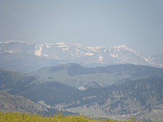
The drive from Hardin, Montana to Wall, South Dakota will cover about 335 miles and will take nearly 7 hours with stops for fuel and food. Along the way, we have a great view of the Big Horn Mountains. Here's a couple of shots of the Big Horn Mountains. Cloud Peak is the highest peak in the Big Horns and is 13,167 feet above sea level.


.JPG)


.JPG)
.jpg)


Now it's time to start the long trek back to Illinois from Hardin, Montana. We are now heading east on I90 and plan to stop in Wall, and Yankton, South Dakota before leaving this state. But, as you know, the best plans are often subject to change.
The drive from Hardin, Montana to Wall, South Dakota will cover about 335 miles and will take nearly 7 hours with stops for fuel and food. Along the way, we have a great view of the Big Horn Mountains. Here's a couple of shots of the Big Horn Mountains. Cloud Peak is the highest peak in the Big Horns and is 13,167 feet above sea level.


At last, we made it to Wall, South Dakota and checked into the Sleepy Hollow Campground. Once we got set up, we walked up town and you'll never guess where we were headed. Oh..you guessed it... Wall Drug store, the store that has everything under the sun. OK, here's the real surprise, you'll never guess what we bought....give up...OK, we bought some hats. I am telling you, this store has it all!
Here's Sean and Craig with our new hats.

I started to do my hat dance, but everyone was laughing so hard, no one took a picture. So, you'll have to take my word for it, it was really something to behold. Ha!
June 25, 2012
We departed Wall, South Dakota heading for Yankton, South Dakota. We had reservations at Chief White Crane State Park, our site was right next to beautiful Lake Yankton. This leg of the trip would cover about 312 miles. Well...almost until I came to my senses.
Wait a minute, Our reservations didn't start until June 26th. Darn, we are a day early. So, we found a nice little campground called Camp America located just off I90 near Salem, South Dakota. Unfortunately, we didn't get any pictures of this campground. But it was nice and clean and well kept. They had a miniature golf course and horse shoes. We played several rounds of miniature golf. I won't tell you who won all the rounds, but his initials are Craig Simmons. I hate to brag, but I also beat Sean in a close game of horse shoes. This may be the last time I beat Sean at anything. He's 15 years old and over 6 feet tall. I used to be 6' 3" but lost a couple inches over the last few years. Hey, if anybody finds 'em, please give 'em back to me!
June 26, 2012
We left Camp America and arrived at Chief White Crane State Park in Yankton. Well..actually, it wasn't quite that easy. My new GPS, made just for RV's, led us down the wrong street and into a dead end. So, here we are at the end of the street with no sight of the state park and no place to turn our 38 foot 5th wheel around. Boy, is this GPS maker going to get an ear full when I tell them what I think of their navigation!
I carefully (I might also add skillfully) backed up the RV about 1/4 mile to an intersection that allowed us to turn around. We headed back to where we saw a sign pointing to Chief White Crane State Park.
Yankton is a historic town. Lewis and Clark stopped here in 1804 and met the first resident of the area, Pierre Dorlan. They convinced Dorlan to accompany them on their expedition and to serve as an Indian interpreter. Dorlan later returned to Yankton and stayed there until his death.
Here we are all set up at Chief White Crane State Park.
.JPG)

Check out this view of Lake Yankton from our campsite.

Sean said it was the perfect day for a swim, and so he did.

Does he look like a movie star or what?

I think Kallie wants to show Sean her favorite tree!
Lake Yankton use to be the old Missouri River path. But, when they built the Gavins Point Dam, they rerouted the river and created the lake in the old river bed. Now the Missouri River runs adjacent to Lake Yankton.
Here's a couple of shots of Craig and Sean at the Gavin Point Dam overlook.
.JPG)
.jpg)
Here's Sean and Kitty at the dam thing!

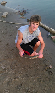
We fished Lake Yankton one evening but the only bites we got were from the bugs. So, the next day Sean scouted out a spot on the Missouri River that was loaded with fish. But, catching the ones you were after was easier said than done because the Gar kept getting in the way.
Sean was brave enough to get this Gar off the hook.

Sean is going after a really big one in the river! Darn! It got away!

I can't tell you how many fish we caught, but I will say we did not have fish for supper.
That's it for South Dakota. The next blog take us back to Illinois using a different route than I90 for a change.
Friday, June 22, 2012
Custer's Last Stand
June 22, 2012
I never liked history in school, but I love it when history comes to life as it does with Custer's last stand. We arrived in Hardin, Montana in time to see a reenactment of Custer's last stand. The reenactment was staged about 30 miles from the actual battlefield but is one of the most historically accurate descriptions of the battle. The script is taken from notes made by Joe Medicine Crow now 98 years old, who was present at the reenactment and spoke before the battle began. His grandfather dictated to him what happened at Little Big Horn on that horrid day in June 25, 1876. The weather today is just like it was back then. Hot, windy, and dusty.
This has nothing to do with the reenactment, but the Budweiser Clydesdales put on a show prior to the reenactment. There's nothing better than a cold Bud on a hot windy day before a big battle!


The reenactment did not mention what the Indians did to the bodies. Since our blog is rated "G", we can't discuss it now. Well, it's really not "G" rated, but, this is a family blog.


I never liked history in school, but I love it when history comes to life as it does with Custer's last stand. We arrived in Hardin, Montana in time to see a reenactment of Custer's last stand. The reenactment was staged about 30 miles from the actual battlefield but is one of the most historically accurate descriptions of the battle. The script is taken from notes made by Joe Medicine Crow now 98 years old, who was present at the reenactment and spoke before the battle began. His grandfather dictated to him what happened at Little Big Horn on that horrid day in June 25, 1876. The weather today is just like it was back then. Hot, windy, and dusty.
This has nothing to do with the reenactment, but the Budweiser Clydesdales put on a show prior to the reenactment. There's nothing better than a cold Bud on a hot windy day before a big battle!
Here's the Clydesdales.

Looks like they are headed to the Indian village!
They're headed back. Guess the Indians didn't want any beer!

Sorry, I digressed there for a minute. The reenactment started with Lewis and Clark crossing through Indian territory. The Indians help Lewis and Clark get through the winter and showed them how to get through the mountains.
Then the pioneers started heading west. As time went on, more and more settlers crossed the Indiansland and killed the buffalo. Finally, the Indians had enough and began attacking the wagon trains. Circle the wagons, we're being attacked!!

You can see the dust this fight kicked up.
Many treaties were made and broken. The US needed to expand in the west and the Indians were in the way. Custer, the boy general as he was called, was actually 36 years old in his final battle.
Here's a picture of Custer in his buckskins. He looks a little older than 36 here in this reenactment. Of course, he's been dead for 136 years!

Here's the battle, near the end.
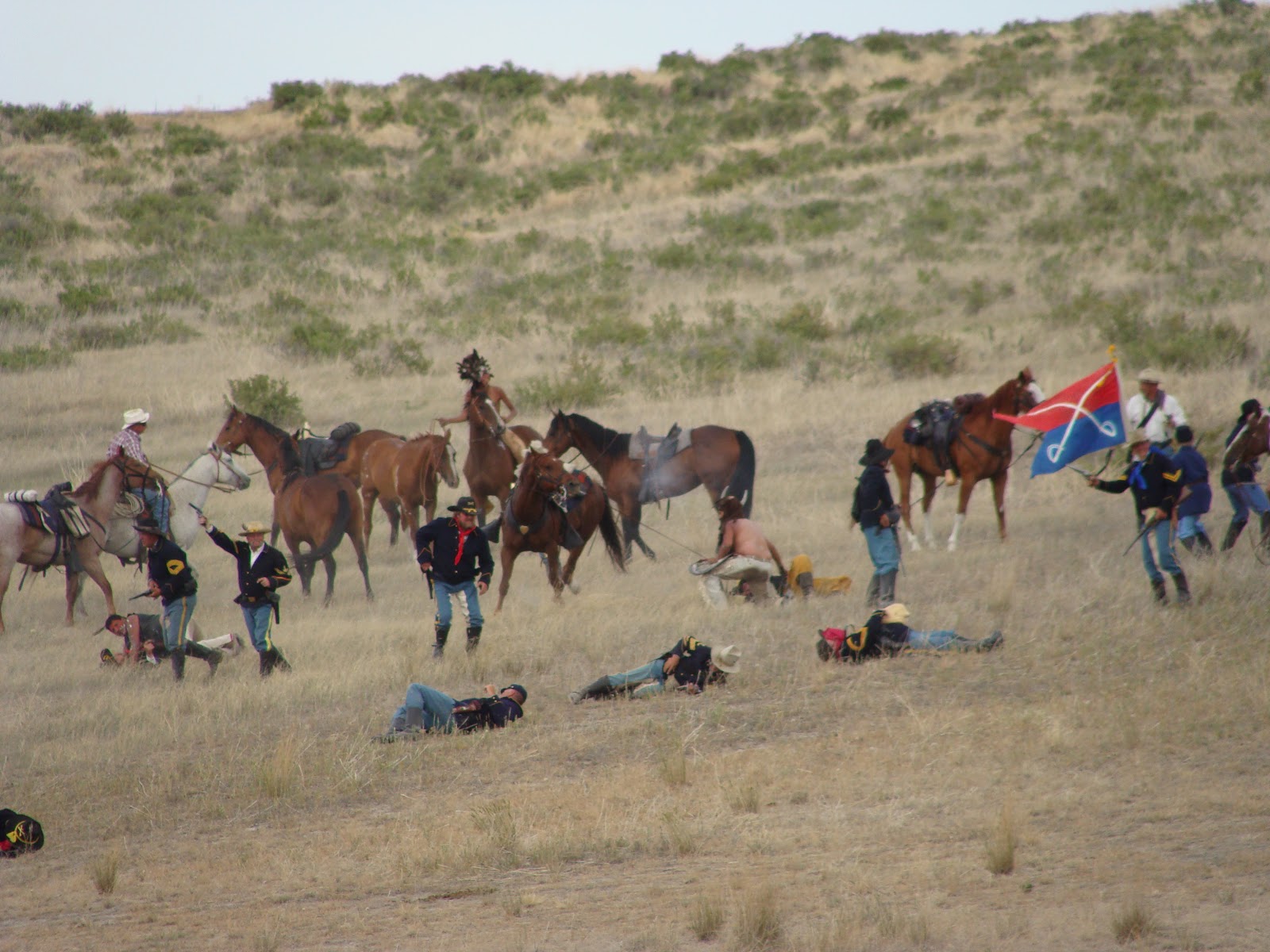
It's over! It's all over! It was estimated it took about 45 minutes to kill Custer and his 220 solders. As the Indians said, the battle lasted "as long as it takes a hungry man to eat his meal".

The reenactment did not mention what the Indians did to the bodies. Since our blog is rated "G", we can't discuss it now. Well, it's really not "G" rated, but, this is a family blog.

The Indians have the flag of the 7th Calvary.
Here's Sean, brave enough to stand in front of some blood thirsty warriors.

June 23, 2012
The day after the reenactment, we went to the real battlefield at Little Big Horn. We were fortunate enough to be with John who has read many books about Custer and the battle at Little Big Horn. He also participated in a couple of archaeological digs at the battle field where he found a ring with the bone still inside. This is now on display at the Battlefield museum.
John took us on the Crow Reservation to see where Custer believed there was an Indian village and was moving in position to attack. He had no idea how many Indians had amassed in the area. Over a dozen tribes and several thousand warriors were gathering and ready to fight. Had Custer known the number of the Indians nearby, he would have certainly made other plans. Instead, he divided his forces with the intention of surrounding the Indian village. The Indians began attacking Custer and his 220 men. There was no cover available to protect the soldiers, so they shot their own horses for cover. But, to no avail. They were vastly out numbered and the Indians were armed with guns and plenty of ammunition. The battle took place in about 45 minutes over a stretch of a couple of miles. Reno and Benteen were not able to bring their troops to Custer's rescue as they were pinned down and couple of miles away.
These are a few of the battle field markers were bodies were actually found. You'll find these all over the battlefield.

Sean and Kitty at the Battlefield.


The monument tells the story of where the remains are buried.

The black marker is the spot were Custer died. Custer's brother and nephew were also killed in this battle.

Next to the battlefield is a National Commentary where soldiers from many wars are buried. Here's Sean, Victoria, John, and Ethan at the National Commentary.

Here is the grave of Marcus Reno, second in command under Custer. Reno and Benteen were able to escape after the Indians suddenly stopped fighting. Reno is from Illinois and died in 1887.

Well, that's the end of our Custer story. Our next blog covers our trip back to Illinois with stops in Wall, and Yankton. You won't believe what we did in Wall on our second visit there and you'll love to see Chief White Crane State Park in Yankton. Stay tuned. It's next!
Wednesday, June 20, 2012
Fort Kearny and the Devil
June 20, 2012
Today we pack up and leave Custer, South Dakota and head to Buffalo, Wyoming with a couple of interesting stops along the way. The first stop is Fort Kearny.
Fort Phil Kearny State Historic Site is a National Historic Landmark located between Sheridan and Buffalo, Wyoming, and was named after a Union general killed during the civil war. The Fort is located near the Big and Little Piney Creeks and was established in July 1866. The Fort was built to protect the settlers heading west on the historic Bozeman Trail. The Fort was abandoned by the army in August 1868, and was burned shortly after by the Cheyenne. Today, a couple sections of the outer wall were rebuilt so visitors can have an idea of the size of the fort. No other part of the Fort has been rebuilt. There is a small museum located on the site.
Because the fort was well fortified, the Indians never directly attacked the fort. However, the fort needed wood for heat and cooking and the nearest supply of timber was several miles away. The daily trek to the trees gave the Indians ample opportunities to attack the wood cutters. Perhaps the most famous fight involving this fort was the Fetterman Fight. Captain Fetterman left the fort with 80 solders to protect the wood cutters from attack. The Sioux and Cheyenne band together to lead Fetterman and his men into a deadly trap. Within 30 minutes, all 80 men had been killed by over 2000 Indians. Only the Battle of Little Big Horn stands as a worse defeat for the army and a great victory for the Indians.
Another story involving an attack on the wood cutters was a private who was shot by the Indians, scalped, and left for dead. However, we wasn't quite dead. He broke off the arrow shaft and managed to crawl some distance to get help. He soon died of his wounds before the doctor arrived.
In these pictures, Sean and his shadow, Ethan, are at the Fort. The hills in the background are the closest stand of timber several miles away. That's how far the wood cutters had to go making their daily trips. It's no wonder the Indians never risked attacking the Fort.


Here we are arriving at the RV parking area. The plan was to unhook and drive up to the base of Devils Tower.


Today we pack up and leave Custer, South Dakota and head to Buffalo, Wyoming with a couple of interesting stops along the way. The first stop is Fort Kearny.
Fort Phil Kearny State Historic Site is a National Historic Landmark located between Sheridan and Buffalo, Wyoming, and was named after a Union general killed during the civil war. The Fort is located near the Big and Little Piney Creeks and was established in July 1866. The Fort was built to protect the settlers heading west on the historic Bozeman Trail. The Fort was abandoned by the army in August 1868, and was burned shortly after by the Cheyenne. Today, a couple sections of the outer wall were rebuilt so visitors can have an idea of the size of the fort. No other part of the Fort has been rebuilt. There is a small museum located on the site.
Because the fort was well fortified, the Indians never directly attacked the fort. However, the fort needed wood for heat and cooking and the nearest supply of timber was several miles away. The daily trek to the trees gave the Indians ample opportunities to attack the wood cutters. Perhaps the most famous fight involving this fort was the Fetterman Fight. Captain Fetterman left the fort with 80 solders to protect the wood cutters from attack. The Sioux and Cheyenne band together to lead Fetterman and his men into a deadly trap. Within 30 minutes, all 80 men had been killed by over 2000 Indians. Only the Battle of Little Big Horn stands as a worse defeat for the army and a great victory for the Indians.
Another story involving an attack on the wood cutters was a private who was shot by the Indians, scalped, and left for dead. However, we wasn't quite dead. He broke off the arrow shaft and managed to crawl some distance to get help. He soon died of his wounds before the doctor arrived.
In these pictures, Sean and his shadow, Ethan, are at the Fort. The hills in the background are the closest stand of timber several miles away. That's how far the wood cutters had to go making their daily trips. It's no wonder the Indians never risked attacking the Fort.


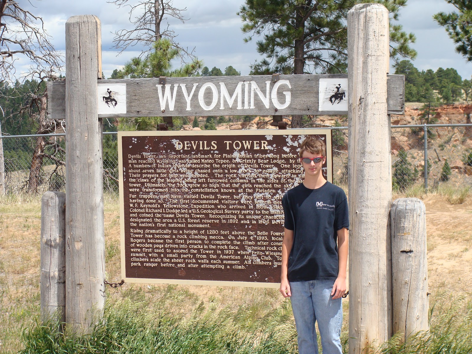
Now it's back on the highway heading towards Devils Tower. Devils Tower is older than I am, about 50 million years give or take a few centuries. The Tower rises 867 feet from its base and is 1000 feet across the base. It is 5112 feet above sea level.
The next photo is Sean standing at the Devils Tower sign in Wyoming.
Here we are arriving at the RV parking area. The plan was to unhook and drive up to the base of Devils Tower.

But, the weather was not cooperating. It was cold, windy, and rainy. So, we decided not to unhook and take some pictures and leave.
Here's a shot of Sean with Devils Tower in the background.

In this photo, some sun rays managed to find the Tower highlighting the base.

We quickly snapped this shot before the wind blew us away!

L to R: Victoria, Ethan, Sean, John, Kitty, Kallie, Sophie, Dale, and Craig. You can see part of Devils tower over my right shoulder. Kallie took this picture! She is faster than the shutter!
Later that day we arrived at Indian Campground and RV Park in Buffalo, Wyoming. We had camp sites next to each other. We met John's brother Richard and his wife Linda. They were kind enough to have supper prepared for us and it was a real treat! Later, John fixed a cobbler over coals in a dutch oven. We ate like kings and our waist line proved it!
Here's a shot of Sean between our rigs.

The next blog we arrive in Hardin, Montana for one of the highlights of the trip, a visit to the battlefield where Custer's last stand happened and a reenactment of the last stand. It's going to be interesting. Don't miss it!
Tuesday, June 19, 2012
Gold Fever!
June 19, 2012
Today we are headed a few miles north of Custer to Keystone, SD to pan for gold. But, first we are stopping at a beautiful small lake in the Black Hills. Sylvan Lake on Needles Highway. We couldn't travel much farther east on Needles Highway because there is a tunnel that is 8 feet 4 inches wide, and my truck is 8 feet wide. That only gives me 2 inches of clearance on each side and I didn't feel very lucky this day. So, we decided not to risk going that far. Besides, Kitty already had her fill of riding on these mountain roads with all the steep inclines/declines, switch backs, and pig tails.
Here's a group shot of the crew at Sylvan Lake.
 From L to R: John, Ethan, Sean, Sophie, Kitty, Dale, Victoria, and Craig. You're probably asking yourself, who took this picture, That my friends shall remain a mystery throughout our trip.


We wish we could have stayed at Sylvan Lake longer. It was so quiet and relaxing and the water was oh so inviting. But, on we went to Keystone in search of gold with hopes of striking it rich.
Keystone, South Dakota, was founded in 1891 and really boomed when gold was discovered there in 1894. Keystone is also the home of Carrie Ingalls of "Little House on the Prairie". She came to Keystone in 1911 and worked on a local newspaper. After ma and pa Ingalls died, Laura Ingalls came to Keystone to live with Carrie and her family.
Gold miners often named their gold mines after their wives. Today, we will pan for gold at the Big Thunder Gold Mine. Hummm. Makes you wonder what his wife must have been like! This mine was built by two Russians. It took them 32 years to complete the mine, so they must have been rushing! Neither died rich.


Today we are headed a few miles north of Custer to Keystone, SD to pan for gold. But, first we are stopping at a beautiful small lake in the Black Hills. Sylvan Lake on Needles Highway. We couldn't travel much farther east on Needles Highway because there is a tunnel that is 8 feet 4 inches wide, and my truck is 8 feet wide. That only gives me 2 inches of clearance on each side and I didn't feel very lucky this day. So, we decided not to risk going that far. Besides, Kitty already had her fill of riding on these mountain roads with all the steep inclines/declines, switch backs, and pig tails.
Here's a group shot of the crew at Sylvan Lake.

Sean at sylvan Lake.

Kitty at Sylvan Lake.
We wish we could have stayed at Sylvan Lake longer. It was so quiet and relaxing and the water was oh so inviting. But, on we went to Keystone in search of gold with hopes of striking it rich.
Keystone, South Dakota, was founded in 1891 and really boomed when gold was discovered there in 1894. Keystone is also the home of Carrie Ingalls of "Little House on the Prairie". She came to Keystone in 1911 and worked on a local newspaper. After ma and pa Ingalls died, Laura Ingalls came to Keystone to live with Carrie and her family.
Gold miners often named their gold mines after their wives. Today, we will pan for gold at the Big Thunder Gold Mine. Hummm. Makes you wonder what his wife must have been like! This mine was built by two Russians. It took them 32 years to complete the mine, so they must have been rushing! Neither died rich.
In this photo, and instructor is showing Victoria how to pan for gold, while John is watches Sean pans for gold.

Sean, John, and Victoria sifting for precious stones.

Ethan and Sophie are trying their luck with Grandpa and Mamaw helping.

Tomorrow, we pack up and leave Custer's Gulch Campground in South Dakota and head for Wyoming. Along the way we will stop at historic Fort Phil Kearney and see Devils Tower. So, don't miss the next blog!
Monday, June 18, 2012
Visiting the Ice Age Museum and Wildlife at Custer State Park
June 18, 2012
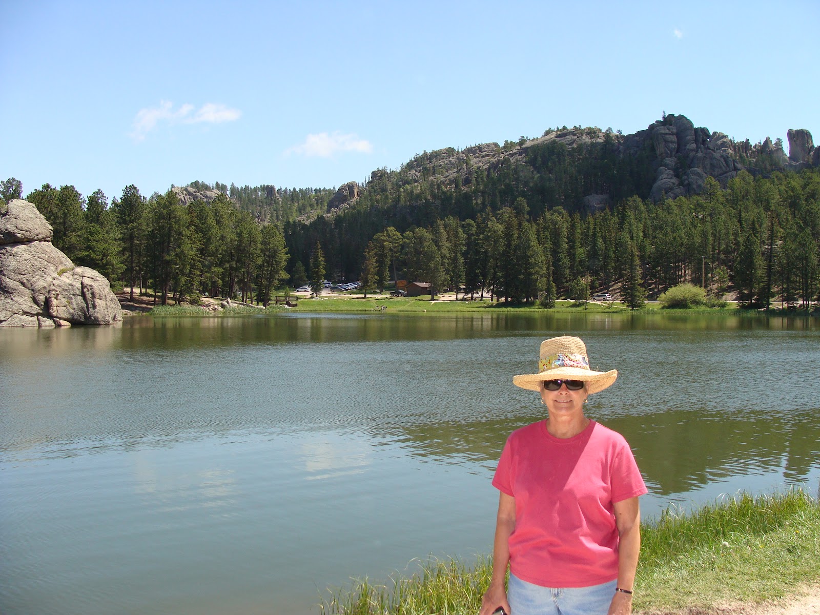
Today we are going to head south to Hot Springs, SD to see an active dig site and Ice Age museum; then head back north to see some wild life, taking the circle drive to the east through Custer State Park and experience the Iron Mountain Road scenery and white knuckle (at least as far as Kitty is concerned) curves and switchbacks.
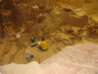
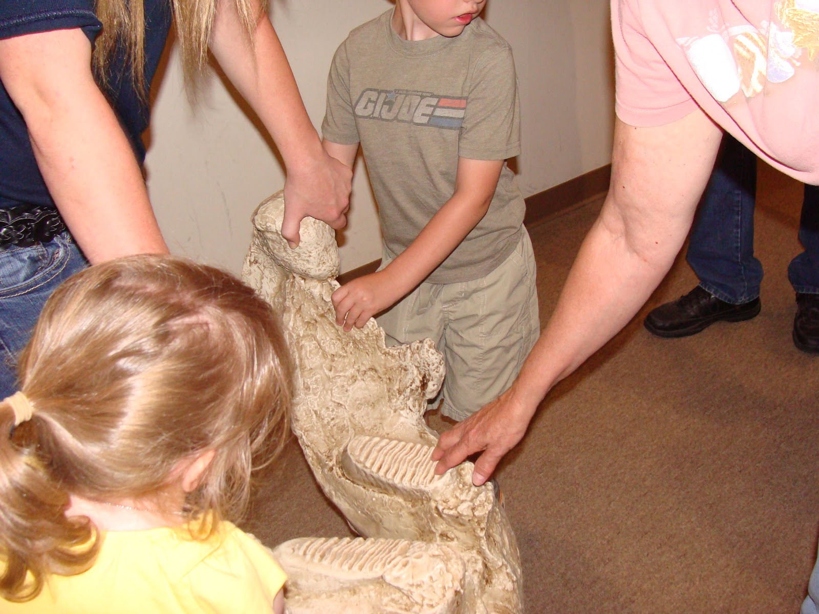
The Hot Springs dig site is where the mammoths came to drink from the spring and ended up getting trapped in the spring about 26,000 years ago. The excavation site is enclosed and the dig of fossil remains continues. The site features fossil remains of 58 Columbia and woolly mammoths and a few other small animals. The site has excavated about 30 feet deep and it is estimated that there is another 70 feet of remains yet to be discovered.
In this shot, Ethan and Sophie are holding the jaw bone of a mammoth and you can see the teeth.

This photo shows the active dig site.
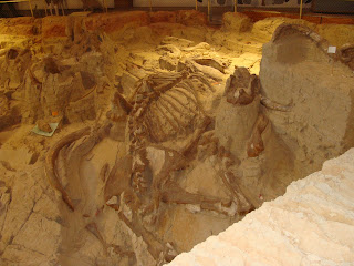
This is one of the most complete skeletial remains of a mommoth ever found.
This is Sean standing in front of a mammoth replica. You get a good idea of the size of these animals.

Leaving the dig site, we head north back to Custer State Park taking the east loop road. There are no fences separating visitors from the wildlife, so everyone is advised to stay in their car. If you look in the upper left corner of this photo, you can see a prairie dog sitting up.

A small herd just crossed the road with two babies. The only wild animals Kallie barked at happened to be the buffalo. Yikes! Don't get them upset and charge our truck! Fortunately, they ignored her barks until we could wrap a hand around her mouth.

This guy picked up a hitch hiker! I guess he got tired carrying that bird around all day!

Here's a close up of a Prong Horn Antelope.

These wild burros know how to beg for food. That's Sean standing behind the burro.

Now we are on the scenic Iron Mountain Road. This is a white knuckle narrow road with lots of switch backs and a few pig tails and steep inclines and descends and some interesting tunnels carved through the rock. After the Iron Mountain Road, Kitty refused to ride on any more "scenic trips through the mountains".
We stopped at this scenic overlook. We could see Mount Rushmore from this road as you will see in the later pictures.
 From the left: Craig, Kitty, Kallie, and Sean.
This picture of John's truck was taken through the windshield of my truck. As you can see, there is only room for one vehicle at a time. Our RV definitely would not fit through this tunnel!

As we drove through this tunnel, it framed Mount Rushmore. The picture was also taken through the windshield of my truck.
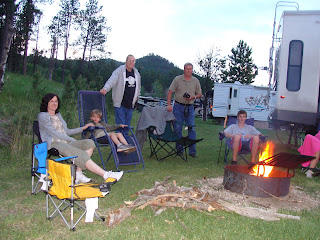
 We headed back to Custer Gulch for supper, and then relaxed around the campfire that evening. It was the perfect ending to another wonderful day in the Black Hills.
The next blog will take us a few miles north of Custer, to Keystone, SD where we will pan for gold and visit beautiful Lake Sylvan.
Today we are going to head south to Hot Springs, SD to see an active dig site and Ice Age museum; then head back north to see some wild life, taking the circle drive to the east through Custer State Park and experience the Iron Mountain Road scenery and white knuckle (at least as far as Kitty is concerned) curves and switchbacks.
The Hot Springs dig site is where the mammoths came to drink from the spring and ended up getting trapped in the spring about 26,000 years ago. The excavation site is enclosed and the dig of fossil remains continues. The site features fossil remains of 58 Columbia and woolly mammoths and a few other small animals. The site has excavated about 30 feet deep and it is estimated that there is another 70 feet of remains yet to be discovered.
In this shot, Ethan and Sophie are holding the jaw bone of a mammoth and you can see the teeth.
This photo shows the active dig site.

This is one of the most complete skeletial remains of a mommoth ever found.

This is Sean standing in front of a mammoth replica. You get a good idea of the size of these animals.

Leaving the dig site, we head north back to Custer State Park taking the east loop road. There are no fences separating visitors from the wildlife, so everyone is advised to stay in their car. If you look in the upper left corner of this photo, you can see a prairie dog sitting up.

A small herd just crossed the road with two babies. The only wild animals Kallie barked at happened to be the buffalo. Yikes! Don't get them upset and charge our truck! Fortunately, they ignored her barks until we could wrap a hand around her mouth.

This guy picked up a hitch hiker! I guess he got tired carrying that bird around all day!

Here's a close up of a Prong Horn Antelope.

These wild burros know how to beg for food. That's Sean standing behind the burro.

Now we are on the scenic Iron Mountain Road. This is a white knuckle narrow road with lots of switch backs and a few pig tails and steep inclines and descends and some interesting tunnels carved through the rock. After the Iron Mountain Road, Kitty refused to ride on any more "scenic trips through the mountains".
We stopped at this scenic overlook. We could see Mount Rushmore from this road as you will see in the later pictures.
This picture of John's truck was taken through the windshield of my truck. As you can see, there is only room for one vehicle at a time. Our RV definitely would not fit through this tunnel!

As we drove through this tunnel, it framed Mount Rushmore. The picture was also taken through the windshield of my truck.


The next blog will take us a few miles north of Custer, to Keystone, SD where we will pan for gold and visit beautiful Lake Sylvan.
Subscribe to:
Posts (Atom)